
DATA CATEGORY
Geographic and location data
Where a business is, at every level from nation down to a rooftop coordinate, with the administrative and statistical geographies that sit over it.
- 62fields
- Available from Complete
WHAT THIS DATA SHOWS
What Geographic covers
Administrative geography
Country, region, county, town and locality, so an audience can be cut to the territory a team actually covers.
Postcode hierarchy
Full postcode with its area, district and sector held separately, which is what makes postcode-level selection possible.
Coordinates
Latitude and longitude at rooftop level, which is what radius and drive-time searches are calculated from.
Statistical geographies
Census and statistical boundaries recorded against the address, for analysis that has to line up with published datasets.
HOW WE BUILD THIS DATA
Sources and maintenance
Sources
Official UK geographic and statistical datasets, including postcode, administrative and census geographies.
Checks
Each business address is resolved to a location and the geographies covering it are attached to the record.
Maintenance
Boundary and postcode changes are picked up as new releases of the official datasets are processed.
INCLUDED FIELDS
All Geographic fields
All 62 Geographic fields, grouped by the first data package that includes them.A field available from Essential is also included with Advanced and Complete.
| Field name | What it contains |
|---|---|
| Ward Code | Local authority ward code for the postcode. |
| Rural Urban 2021 | 2021 Census rural/urban classification for the postcode. |
| Roads | Nearby road name(s) associated with the postcode. |
| Middle Layer Super Output Area 2021 | 2021 Middle Layer Super Output Area name. |
| Lsoa21 Code | 2021 Lower Layer Super Output Area code. |
| Lower Layer Super Output Area 2021 | 2021 Lower Layer Super Output Area name. |
| Imd Decile | Index of Multiple Deprivation decile (1 = most deprived) for the postcode's area. |
| Fixphrase | Doogal 'fixphrase' three-word style location identifier for the postcode. |
| District Code | Local authority district code for the postcode. |
| Constituency Name 2024 | Parliamentary constituency name (2024 boundaries). |
| Constituency Code 2024 | Parliamentary constituency code (2024 boundaries). |
| Constituency Code | Parliamentary constituency code (pre-2024 boundaries). |
| Census Output Area 2021 | 2021 Census Output Area code for the business's postcode. |
| Udprn | Royal Mail Unique Delivery Point Reference Number for the address. |
| Postcode Property Type | Predominant property type recorded for the postcode. |
| Msoa21 Code | 2021 Middle Layer Super Output Area code. |
| Toid | Ordnance Survey TOID (topographic identifier) for the address. |
| UPRN | The Unique Property Reference Number for the business address. |
| Grid Reference | The Ordnance Survey grid reference for the address location. |
| Altitude | The elevation above sea level of the address location, in metres. |
| Index of Multiple Deprivation | A relative measure of deprivation for the postcode's local area, based on official government statistics. |
| Distance to Nearest Station | The approximate distance from the address to the nearest railway station, in miles. |
| Distance to Sea | The approximate distance from the address to the nearest coastline, in miles. |
| District | The local authority district the address falls within. |
| Ward | The electoral ward the address falls within. |
| Constituency | The Westminster parliamentary constituency the address falls within. |
| LSOA Code | The code for the Lower Layer Super Output Area covering the address. |
| Lower Layer Super Output Area | The name of the Lower Layer Super Output Area (a small statistical geography) covering the address. |
| MSOA Code | The code for the Middle Layer Super Output Area covering the address. |
| Middle Layer Super Output Area | The name of the Middle Layer Super Output Area (a mid-sized statistical geography) covering the address. |
| Parish Code | The official code for the civil parish covering the address. |
| Parish | The civil parish the address falls within, where applicable. |
| Country | The country the address is located in. |
| National Park | The name of the national park covering the address, if applicable. |
| Built-up Area | The name of the built-up area containing the address. |
| Built-up Subdivision | The name of the built-up area subdivision containing the address. |
| Rural Urban Classification | Classifies the address location as urban or rural based on official statistics. |
| Region | The official UK region the address falls within. |
| London Zone | The London transport fare zone covering the address, where applicable. |
| Local Authority | The local authority responsible for the address area. |
| Census Output Area | The smallest census geography area code covering the address. |
| Nearest Station | The name of the railway station closest to the address. |
| Postcode Area | The one or two-letter postcode area code. |
| Postcode District | The postcode district (area code plus district number). |
| Police Force | The police force responsible for the address area. |
| Water Company | The water supply company responsible for the address area. |
| Plus Code | The Google Plus Code (Open Location Code) for the address location. |
| Sewage Company | The water and sewerage company responsible for the address area. |
| Travel to Work Area | The official Travel to Work Area covering the address. |
| ITL Level 2 | The International Territorial Level 2 statistical region covering the address. |
| ITL Level 3 | The International Territorial Level 3 statistical area covering the address. |
| Easting Rooftop | The rooftop-level Ordnance Survey easting coordinate of the address, geocoded to the building rather than the postcode centroid. |
| Northing Rooftop | The rooftop-level Ordnance Survey northing coordinate of the address, geocoded to the building rather than the postcode centroid. |
| Latitude Rooftop | The rooftop-level latitude coordinate of the address, geocoded to the building rather than the postcode centroid. |
| Longitude Rooftop | The rooftop-level longitude coordinate of the address, geocoded to the building rather than the postcode centroid. |
| Latitude Postcode | The postcode-centroid latitude coordinate of the address. |
| Longitude Postcode | The postcode-centroid longitude coordinate of the address. |
| Easting Postcode | The postcode-centroid Ordnance Survey easting coordinate of the address. |
| Northing Postcode | The postcode-centroid Ordnance Survey northing coordinate of the address. |
| Geo Population | The estimated resident population of the surrounding geographic area. |
| Geo Households | The estimated number of households in the surrounding geographic area. |
| Geo Avg Income | The estimated average household income for the surrounding geographic area. |
PUT IT TO WORK
How Geographic data is used
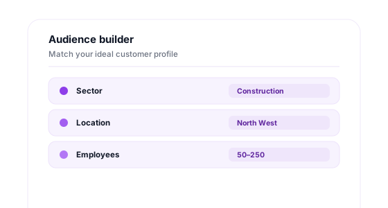
Use these fields to build a territory audience, place your own records on the map and plan coverage.
Build a territory audience
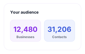
Select by region, postcode or a radius around your own sites, and see the count before you order.
- Radius search
- Drive time
- Postcode select
- Live counts
Place your own records
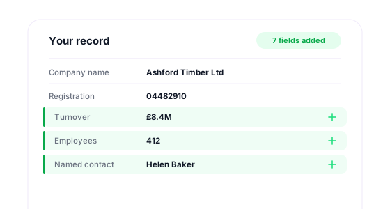
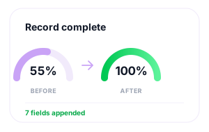
Attach coordinates and geography to the addresses you hold so your customers can be mapped and grouped.
- Add coordinates
- Standardise
- Assign regions
- Fill gaps
Map and plan
Export location fields into the mapping and analysis tools your team plans coverage with.
- Territory plans
- Field routing
- CSV export
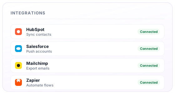
- Zapier
GET STARTED
Build an audience using Geographic
Search UK businesses, select the fields you need and see the price before you order.
Create an audienceFree to sign up · Instant access · No credit card required
Buy with confidence
No sales call needed
Sign up, search and buy online whenever you are ready.
Price match guarantee
Found comparable business data for less? We’ll match the price.Guarantee terms apply
Refund guarantee
If eligible data does not meet our promised standard, we’ll refund it.Guarantee terms apply
Help from real data experts
Speak directly to our UK data team whenever you need support.
Want to see every field first?
Browse all 350+ fields →